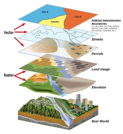
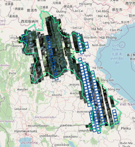
SPEL has full experience and ability to provide consultation services for the governmental projects; SPEL has been providing consultation services for several Chinese state-owned company for developing Hospital Projects, Educational Projects, Science & Technology Projects, Hydro Power Projects in Lao PDR.
1.1 Construction Survey
1.2 Road & Bridge Survey
1.3 Hydropower Survey
1.4 Pipeline and Transmission Line Survey
1.5 Mapping & Designing
1.6 Using GNSS RTK for Cadastral and Land Survey
SPEL provides Survey & Mapping Instruments from various brands, for sale and rent. The customers can also pay by installment for long and short term
SPEL established a local survey & mapping instrument platform which is equipped by our professional engineers.
SPEL also provides an after-sales service covering training on instrument using, and regular or when needed instrument check
Continuously Observation Reference Station (CORS) mainly refers to a network of GNSS receiver which provides an accuracy navigation and position information system to the coverage area by using Internet Technology to connect CORS network to the operation center.
CORS is one of the modern information technologies for real-time, fast and high accuracy access to spatial data and geographical features. It is a multifaceted product of global positioning technology, computer network technology and digital communications technology.
1.1 Satellite Imagery
1.2 UAV Solution